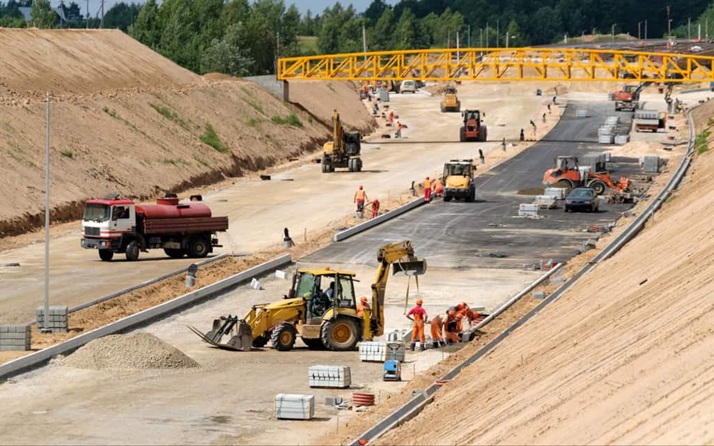
Road construction involves much more than simply laying down asphalt on bare earth. Creating a long-lasting, durable road requires exceptional accuracy at every stage of construction, from moving earth to laying strong, stable bases. Crews need access to current information of conditions on the ground to make important decisions that keep projects on track. Software for drone mapping is helping them do just that. The building construction industry has been revolutionized by drone surveying services.
Aerial surveys with drones provide road construction teams with a bird’s-eye view of real-time conditions on the jobsite. And, with the Propeller Aero drone data processing system, site managers and workers in the field have instant access to information that helps them hit their grades, spot problems early, and improve overall efficiency. Here are some of the ways frequent drone surveys, coupled with Propeller’s optimized workflow, can streamline the complex and precise work of road construction. In locations where poor-quality, out-of-date, or even no data are available, drone surveyor produce highly detailed 3D models and orthomosaics.
Measure earthwork quantities
For a road to remain smooth and stable during years of service under heavy traffic, the earth below it must provide uniform support. Crews first clear the area of vegetation and obstructions and shape the soil with graders and bulldozers. Then, they lay a base layer of soil followed by an aggregate layer.
Propeller’s PPK workflow makes it easy for you to ensure each layer matches specification. After completing your road survey, the Propeller platform helps you measure a cross-section of layers against the final design, so you have a precise measurement of the work you’ve completed compared to the final design.
On every type of job site, surveys by drones are becoming more frequent. Because drones have become the preferred tool of choice for surveyors on a wide range of projects, they’re increasingly being used on paving jobs. See more photos at this site.
Measure subgrade subbase
The most important part of a new road is the subgrade and subbase. Proper installation provides a stable surface to support new pavement and acts as a frost barrier to prevent damage to the pavement surface from freezing and thawing. During this phase of construction, confirming base thickness, stability, and compaction is essential.
Drone surveying with the Propeller platform lets you capture and visualize your data in a 3D model of the site. Crews can refer to the model to ensure subgrade, subbase, and base course are on-grade, allowing them to make adjustments if needed and avoid costly rework.
On every type of job site, surveys by drones are becoming more frequent. Because drones have become the preferred tool of choice for surveyors on a wide range of projects, they’re increasingly being used on paving jobs. See more photos at this site.
Track progress
Traditional surveys done by helicopter or on foot are inefficient and costly. That’s why more and more road construction teams are using drones to fly their sites for more frequent progress updates. In some cases, it makes practical sense for crews to fly the site as frequently as once per week, providing up-to-date data of ground conditions.
With drone surveying, you can capture images of roadwork as it progresses, and — using Propeller’s Timeline feature—you can quickly calculate whether key project milestones are on-time or behind schedule. Equipped with accurate information and an aerial view of a site, site managers can make better decisions, faster. Whether you need to reallocate crew, material, or equipment to meet a tight deadline, drone data helps you make important decisions without hesitation, reducing project delays that can negatively impact the financial status of the project.
Stage material efficiently
Rework on roadwork projects of any size or scope can be very costly for construction crews. Teams are increasingly employing drone photogrammetry to assist with material staging in set intervals. The Propeller Platform provides you with all the tools you need to measure temporary stockpiles — that means no more guessing as to the material quantities you have on site, or where that material is.
Drone surveys help you measure off-site materials, too. Crews that have a stockyard and recycle blacktop can use drones to survey and measure their stockpiles. You’ll always have access to up-to-the-minute data on material quantity, helping you manage your material moves.
Drone data is positively transforming road construction
Drone surveying with Propeller’s optimized workflow streamlines road construction in many critical ways. From ensuring accurate grades to streamlining material allocation, drones are improving efficiency in road construction, making it easy for crews to track progress and stay on-course every step of the way.


