Modern technologies are being intensively introduced into agricultural practices. Among the main trends are precision farming tech, hydroponic systems, cloud services for managing an agricultural enterprise, and various monitoring systems. Among other modern technologies, an important place in the provision of information is occupied by Earth Remote Sensing (ERS) technologies, which offers reliable and relevant satellite retrieved data on the state of agricultural lands.
Earth Remote Sensing (ERS) plays the key role in modern agriculture, offering reliable and relevant satellite data providing valuable insights about the state of crops.
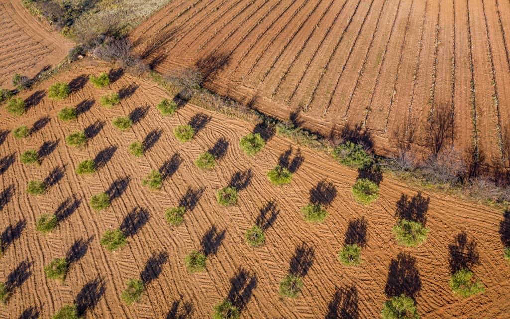
What do olive trees have to do with all of this? Management of plantations and gardens is also being extensively modernized. When it goes beyond herb garden kits that can be used for home planting, there are big gardens and plantations that are very hard to manage. Same with olive trees. But thanks to advanced technology, olive trees can now be automatically detected and analyzed by different tools that leverage satellite data for fields, gardens, plantations, and forests monitoring. Let’s see the basic principles of this method.
Satellite Monitoring Opportunities for Gardening
Those who have a garden are constantly dealing with weed management, an unexpected early harvest, aphids attack, and other immediate threats. All these need to be addressed as urgently as possible. But if a vegetable garden is only a few square meters and is relatively easy to manage, an agricultural land or a plantation is a completely different story.
That is when relevant satellite imagery can help to make a qualitative assessment of plants health, identify damage by diseases and pests, and decide when to apply pesticides, fertilizers, and water. Based on the results of remote sensing data analysis, recommendations for the differentiated application of mineral and organic fertilizers can be offered.
For such plants analysis, vegetation indices are used. They help with both identifying the ecological characteristics of the earth’s surface and to detect large objects on the surface, such as olive trees. Among many vegetation indices, the most used is the NDVI.
NDVI (Normalized Difference Vegetation Index) is a simple quantitative measure of the amount of photosynthetically active biomass (commonly called the vegetation index). One of the most common and used indices for solving problems using quantitative estimates of vegetation cover.
Besides, remote sensing technology allows determining tree height and crown diameter, creating a map of the garden and a garden layout. Having the map of their garden, the growers can easily estimate the number of trees and large shrubs per unit area and the distance between them, dividing them into several classes in height. All that is to help identify the growth stage of plants to treat them accordingly.
But how exactly does that help in olive trees plantations management? Why do gardeners need satellites for help?
Olive Trees Satellite Monitoring
The main issue with the monitoring of olive trees gardens is that the growing lands are usually located in remote areas, which means more time and effort to just get there for trees inspection.
Apart from that, the structure of plantations and the olive trees themselves also complicates their assessment. That is because olive trees are not bright green color by nature and have a sparse crown. Besides, the trees are located at a considerable distance from each other.
Remote sensing technologies can help greatly facilitate monitoring of such plantations. At least, allowing for remote tracking of trees’ vegetation and weather in the growing region using Sentinel 10 m / pix data. And if it may not be enough for in-depth olive trees monitoring, there is an option of using high-resolution imagery to help.
But why not use drones instead of satellites for that matter? The issue with drones is that they are more expensive. Another option is scouting, but doing it without having any information beforehand is economically unprofitable. Having a satellite image of the plantation and seeing if there is an issue and where exactly, makes scouting way more time-consuming and profitable. To enjoy the benefits of satellite monitoring, it’s best to choose a tool that only has a built-in algorithm of satellite data analysis. One of those is EOS Crop Monitoring.
Read More: Should We Fear? Does Starlink Blank the Earth with Deadly 5G?
EOS Crop Monitoring
Here is how Crop Monitoring tool can help in olive trees management:
Weather
We provide advanced weather data: historical, current, and most importantly – a reliable 14 days forecast. Using historical data along with vegetation indices, farmers are able to identify the patterns of weather influence on the plants, planning field activities accordingly. Weather risk prediction allows for preventing plant damage, thus reducing yield losses.
Vegetation indices
One of the biggest advantages of satellite monitoring is the ability to use already calculated vegetation indices, NDVI in particular. Using the combinations of various indices, it is much easier to access the state of olive trees. For instance, an available moisture index (MSAVI) allows for assessing the amount of water the trees need and whether there is a threat of water stress and yield losses.
One screen – Several gardens
The most problematic issue with olive tree gardens monitoring is the distance. The gardens are often too far from each other, which makes it difficult to manage them all at the same time. That is when satellite data helps. In Crop Monitoring, gardeners can monitor several olive tree gardens on one screen remotely. They don’t have to go and inspect each of them “manually”. Besides, it is also possible to view the rating of all the gardens or farms using the Field Leaderboard feature, identifying those that require special attention. Applying satellite monitoring to organic gardening and farming allows managing big and distant gardens and plantations in real time, tracking the state of trees based on satellite data. A significant advantage is also a high level of automation of management processes, which helps cut costs and reach higher efficiency.


